


Abbayie de Torronet

avdem
User
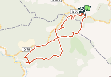

Length
11.9 km

Max alt
324 m

Uphill gradient
276 m
Km-Effort
15.6 km

Min alt
185 m

Downhill gradient
283 m
Boucle
Yes
Creation date :
2022-09-15 07:12:33.065
Updated on :
2022-09-20 10:03:09.336
6h13
Difficulty : Easy

FREE GPS app for hiking
 SityTrail
IGN / Geographical institutes
SityTrail Plus
The world is yours!
About
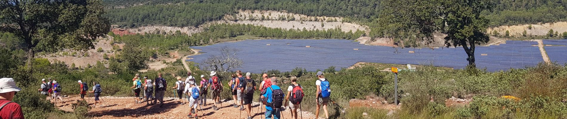
Trail Walking of 11.9 km to be discovered at Provence-Alpes-Côte d'Azur, Var, Le Thoronet. This trail is proposed by avdem.
Description
bien
Photos


Positioning
Country:
France
Region :
Provence-Alpes-Côte d'Azur
Department/Province :
Var
Municipality :
Le Thoronet
Location:
Unknown
Start:(Dec)
Start:(UTM)
278443 ; 4815588 (32T) N.
Comments